
The Bridges That Built Delmarva: Bay Bridge, Bay Bridge-Tunnel & Beyond
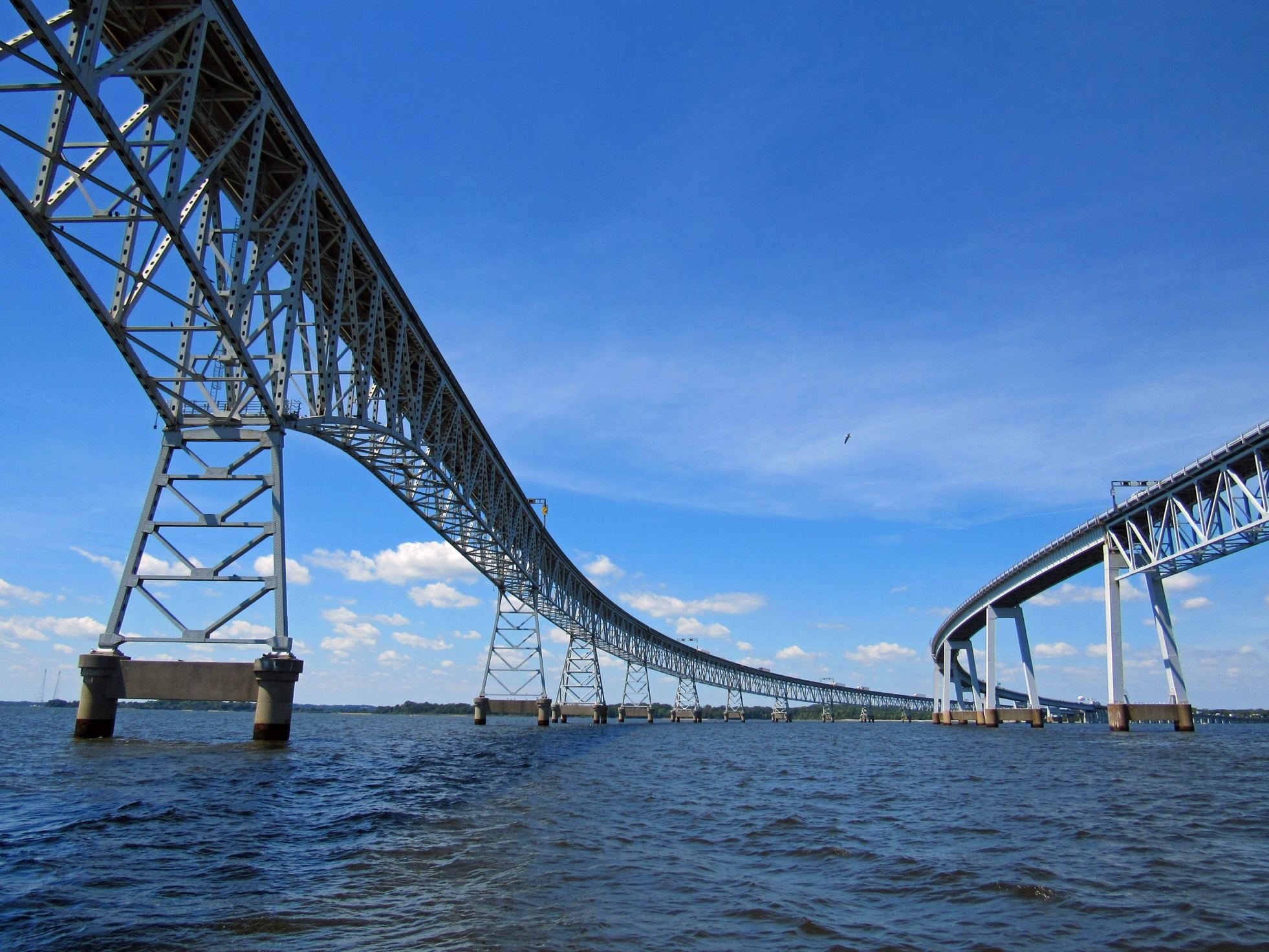
Delmarva is a peninsula — nearly an island — and its bridges aren't just roads. They're the reason the rest of the world can get here, and the reason leaving feels like an event. Here's your guide to the spans that define our corner of the map.
The Gateway: Chesapeake Bay Bridge, Maryland
If you live on Delmarva, you know the feeling: cresting the top of the Bay Bridge, the whole Chesapeake spread out below, and the Eastern Shore waiting on the other side. Officially the Governor William Preston Lane Jr. Memorial Bridge — locally, just "the Bay Bridge" — this is the front door to the Delmarva Peninsula for millions of visitors a year.
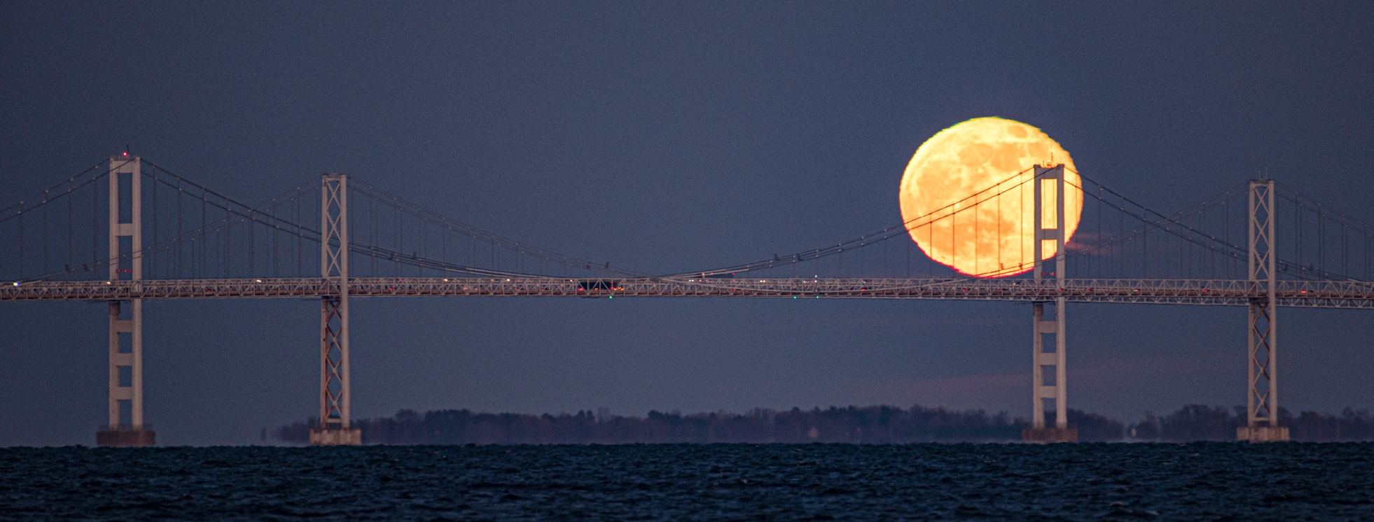
The facts: The crossing runs about 4.3 miles from Sandy Point State Park (near Annapolis) to Kent Island, carrying US 50 and US 301. It's actually two bridges side by side: the original eastbound span opened July 30, 1952 — at the time the world's longest continuous over-water steel structure — and the parallel westbound span followed in 1973. At its highest point, the roadway sits 186 feet above the water, high enough for ocean-going ships to pass beneath.
Before the bridge, there were ferries. For generations, crossing the Bay meant a ferry ride — an outing in itself, but a bottleneck for a growing region. The bridge changed everything: it turned Ocean City, Rehoboth, and the whole Eastern Shore from remote outposts into accessible destinations, and it made the daily commute between shore and city possible.
The drive: First-timers, take note — the Bay Bridge has a reputation. The westbound span's curves and the sheer height make some drivers white-knuckle it (there's even a drive-across assistance service for nervous drivers — ask a local). About 61,000 vehicles cross daily, and summer weekends can stack traffic for miles. The toll is collected eastbound only. (Check the current toll before you cross.)
Make it a stop, not just a crossing: Sandy Point State Park sits at the western foot of the bridge — beaches, fishing, and the best bridge photography on the Shore. On the eastern side, Kent Island welcomes you with marinas, seafood restaurants, and the start of the Eastern Shore proper.
The Wonder: Chesapeake Bay Bridge-Tunnel, Virginia
Now for the one that makes engineers weep. The Chesapeake Bay Bridge-Tunnel — officially the Lucius J. Kellam Jr. Bridge-Tunnel — is a 23-mile fixed link (17.6 miles shore to shore) connecting Virginia Beach and Hampton Roads to Virginia's Eastern Shore. That's right: it lands on Delmarva.
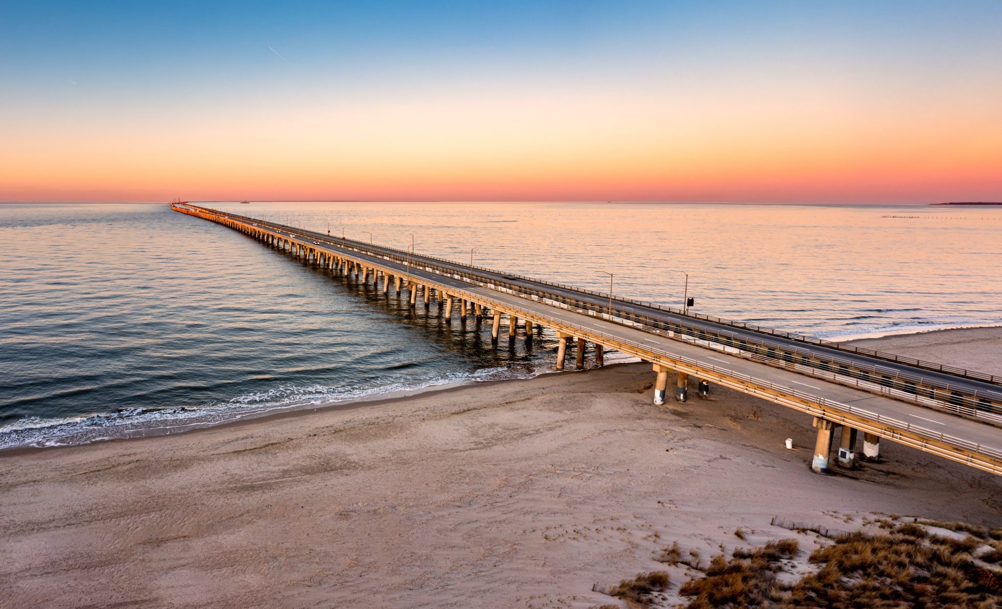
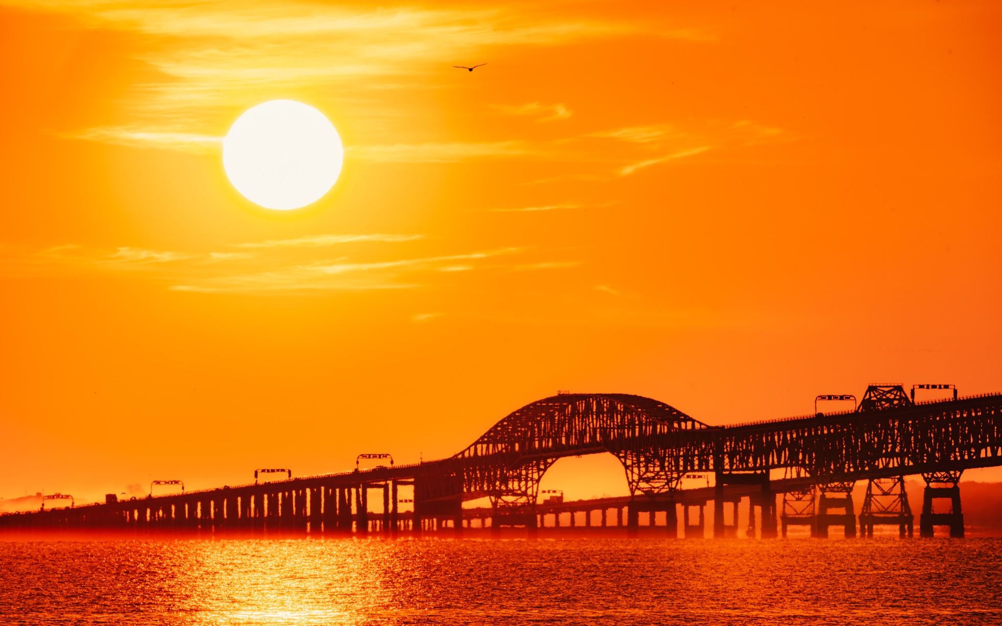
The facts: Opened April 15, 1964, the crossing combines 12 miles of low-level trestle, two mile-long underwater tunnels, four artificial islands, and high-level bridges — all in a single continuous roadway carrying US 13. A set of parallel bridges opened in 1999. It replaced vehicle ferries that had run since the 1930s. In 1965 it was designated one of the Seven Engineering Wonders of the Modern World, and more than 100 million vehicles have crossed since.
The experience: Driving the CBBT is unlike any other road trip on the East Coast. You're skimming just above open water for miles, then — through a portal on a man-made island — you dive under the shipping channels in a tunnel, surface again on another island, and keep going. Massive container ships pass overhead while you're below them. It never gets old.
Why it matters to Delmarva: The Bridge-Tunnel is Virginia's Eastern Shore's lifeline — and your direct route from the Delaware and Maryland beaches down through the Shore to the Outer Banks and beyond. Coming north, it's the grand entrance: you surface from the tunnel, cross into Northampton County, and you're on the peninsula, with Cape Charles's charming downtown minutes away.
Don't miss: There's a fishing pier mid-crossing (the Seagull Pier) — yes, you can stop in the middle of the Chesapeake Bay and fish. Tolls apply in both directions; E-ZPass works. (Check the current toll before you cross.)
Delaware's Own: The Indian River Inlet Bridge
Delaware's signature span is the Charles W. Cullen Bridge over the Indian River Inlet — the cable-stayed bridge with the soaring pylons you've seen in every beach-town photo. Opened in 2012, it replaced a series of earlier bridges that the inlet's shifting sands and brutal storms kept defeating.
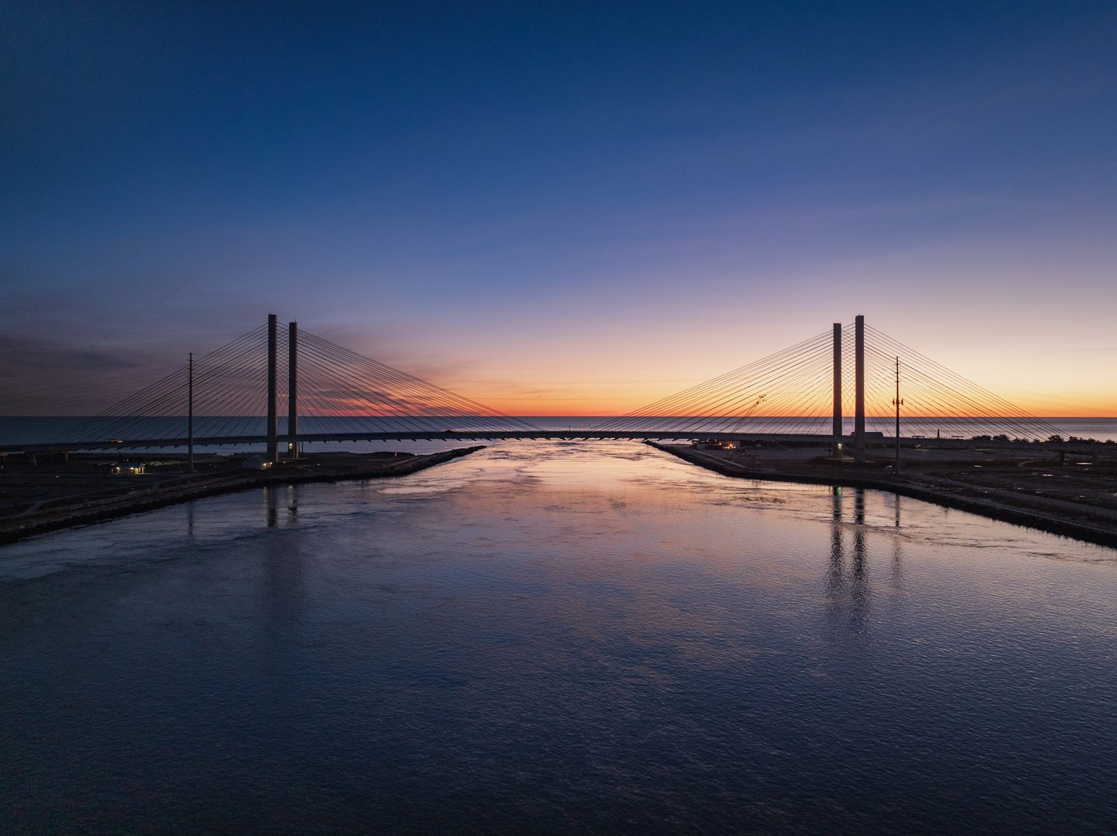
It connects Dewey Beach and Rehoboth to Bethany Beach and Fenwick Island along Coastal Highway — which is to say, it connects the Delaware beach experience end to end. Drive it at sunset with the sails of the inlet below you and try not to pull over for a photo. (There's a designated overlook — use it.)
The bridge also anchors Delaware Seashore State Park, with fishing from the inlet's jetties, the Indian River Life-Saving Station museum nearby, and some of the best surf-fishing access in the state.
The Workhorses: C&D Canal Bridges
Northern Delaware's Chesapeake & Delaware Canal — the waterway that technically makes Delmarva a peninsula rather than an island — is crossed by a trio of modern spans: the Roth Bridge (US 301), the St. Georges Bridge (US 13), and the Summit Bridge. They don't get the glory, but the Roth Bridge in particular is a striking cable-stayed structure worth a look if you're passing through.
Tips for Driving Delmarva's Bridges
- Time the Bay Bridge. Summer Fridays eastbound and Sundays westbound are the worst. Midday midweek is a breeze. Check traffic before you commit — backups are measured in miles, not minutes.
- Mind the wind. High-profile vehicles can face restrictions in strong winds on both the Bay Bridge and the CBBT. If it's howling, check conditions before you go.
- Keep E-ZPass handy. All three major crossings are toll facilities, and electronic tolling keeps you moving.
- The tunnels have rules. No stopping in the tunnels (obviously), hazardous materials are restricted on the CBBT, and the whole crossing is patrolled.
- Make the crossing part of the trip. Sandy Point, Kent Island, Cape Charles, the Seagull Pier, the Indian River Inlet overlook — the bridges come with destinations attached. Plan for them.
Why Bridges Belong in a Home Magazine
Because on Delmarva, the bridge is the lifestyle. It's the commute that starts with a sunrise over the Bay. It's the Friday-night exodus to the beach house and the Sunday return. It's what makes a peninsula feel connected instead of isolated — and what makes coming home feel like arriving somewhere that matters.
Every time you cross, you're driving through the reason Delmarva is Delmarva.
Next time you're on the Bay Bridge at golden hour, windows down, the whole Chesapeake glittering below — that's not a commute. That's the best free show on the East Coast.